Following the Camino Real to its final destination, the Chicamocha Canyon, can be an incredibly rewarding experience for those wishing to take up the challenge. Small gorgeous villages where time stopped long ago, old ghosts towns isolated from the world and breathtaking landscapes are just a small part of what you will experience.
About the trail
Back in the past the Camino Real was a trail used to trade goods and resources in-between nearby villages from one side to the other of the Chicamocha Canyon but today it has become a relatively off-the-beaten track hiking trail for all those trekkers loving countryside adventures.
Currently, the whole trail is an impressive 42.5km of path that will take you through farmlands, forest, villages, in & out a canyon and even to cross a ghost town. Even though the trail is well marked all along the way, some parts might still a bit tricky to walk on and therefore having a map app with the trail visible (we use maps.me) or speaking good enough spanish to ask locals for directions should be considered a MUST.
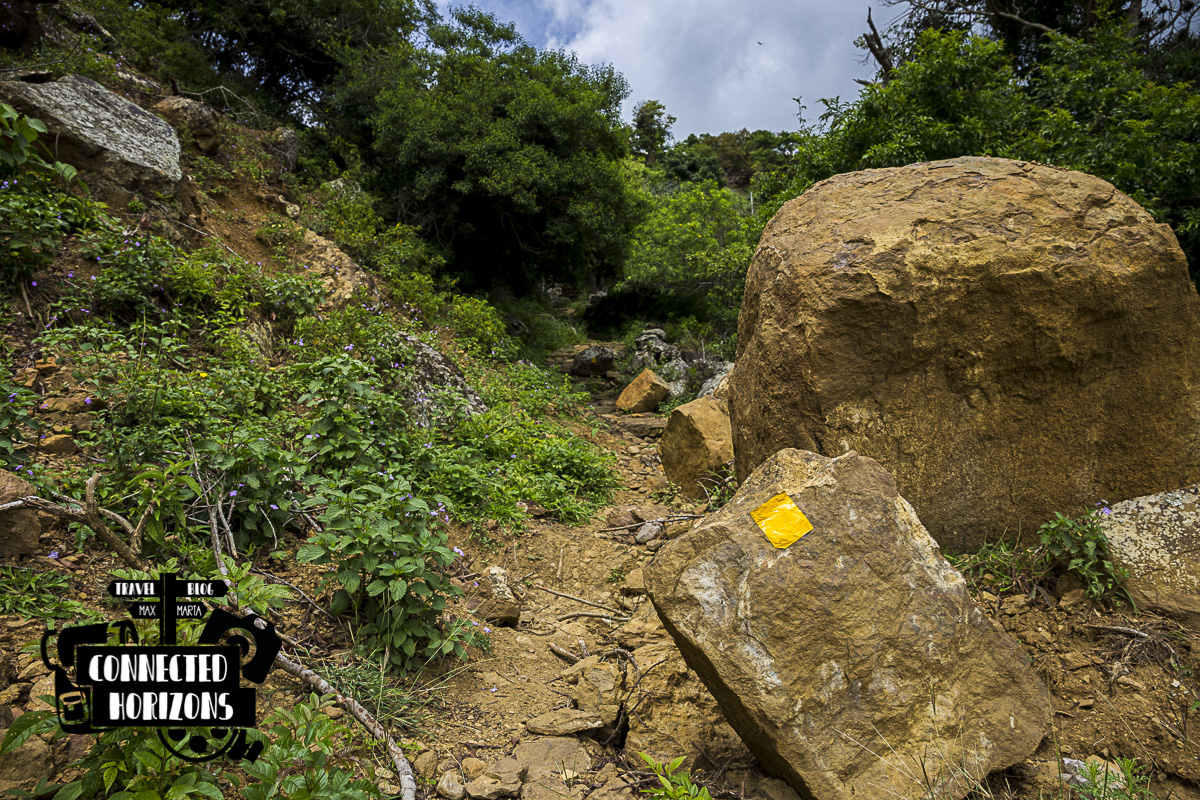 Well-marked trail
The starting point for the trail is in the small town of Cabrera, then the trail will follow on to the pretty town Barichara, the tiny village of Guane, the slightly busier Villanueva, the ghost town of Jordan (although some people still live there) and will end with the arrival in the town of Los Santos. The town of San Gil is a great base for organizing the trek! Here some useful info about the trails:
· Cabrera to Barichara 7km – A 2h mostly uphill hike with lots of nature; the highlight is to visit the town of Barichara.
· Barichara to Guane 6km – A 2h mostly downhill hike on well-kept trail with lots of nature; highlight is visit the town of Guane.
· Guane to Villanueva 9km – A 3h3min mostly flat hike through farmlands on an easy trail; highlight is the variety of local lifestyle you’ll see.
· Villanueva to Jordan 15km – A 4h30min mostly flat hike through farmland and descent into the Canyon; highlight are the beautiful views of the Canyon.
· Jordan to Los Santos 5.5km – A 3h steep ascent to the Canyon top completely through nature; highlight are views of the Canyon.
In order to complete the Camino Real from beginning to end, you’ll need to consider a minimum of two days/one night out (if you have little time and are in good shape) which could stretch to a relaxed three days/two nights itinerary. Remember that all villages mentioned have some kind of basic accomodation available (some even fancy ones), so bringing a tent is not strictly necessary. Guane, Villanueva and Jordan are usually the villages where trekkers stop to sleep.
Our Hike to the Canyon
The idea of trekking all the Camino Real was quite tempting but due to the unstable weather at this time of the year (during our time in San Gil clouds and rain were the norm) we both agreed that doing only a part of it would have been a better option. At the end of the day, what we were really looking forward was to witness the Chicamocha Canyon in all its beauty and that meant starting either in Villanueva or Los Santos. From San Gil, the journey to Los Santos is pretty long so… we’ve got a winner: Villanueva!
Now the second question is, will we do the whole trail Villanueva-Jordan-Los Santos, just Villanueva-Jordan or Villanueva-Mirador del Canyon ?
The morning after we leave from San Gil at 7am and in less than an hour the bus is already pulling up in the city center of Villanueva. The town is small and its pretty easy to find where the start of the trail is; we take a couple of blocks right, one left and there it is, finally we can say we’re walking on the Camino Real!
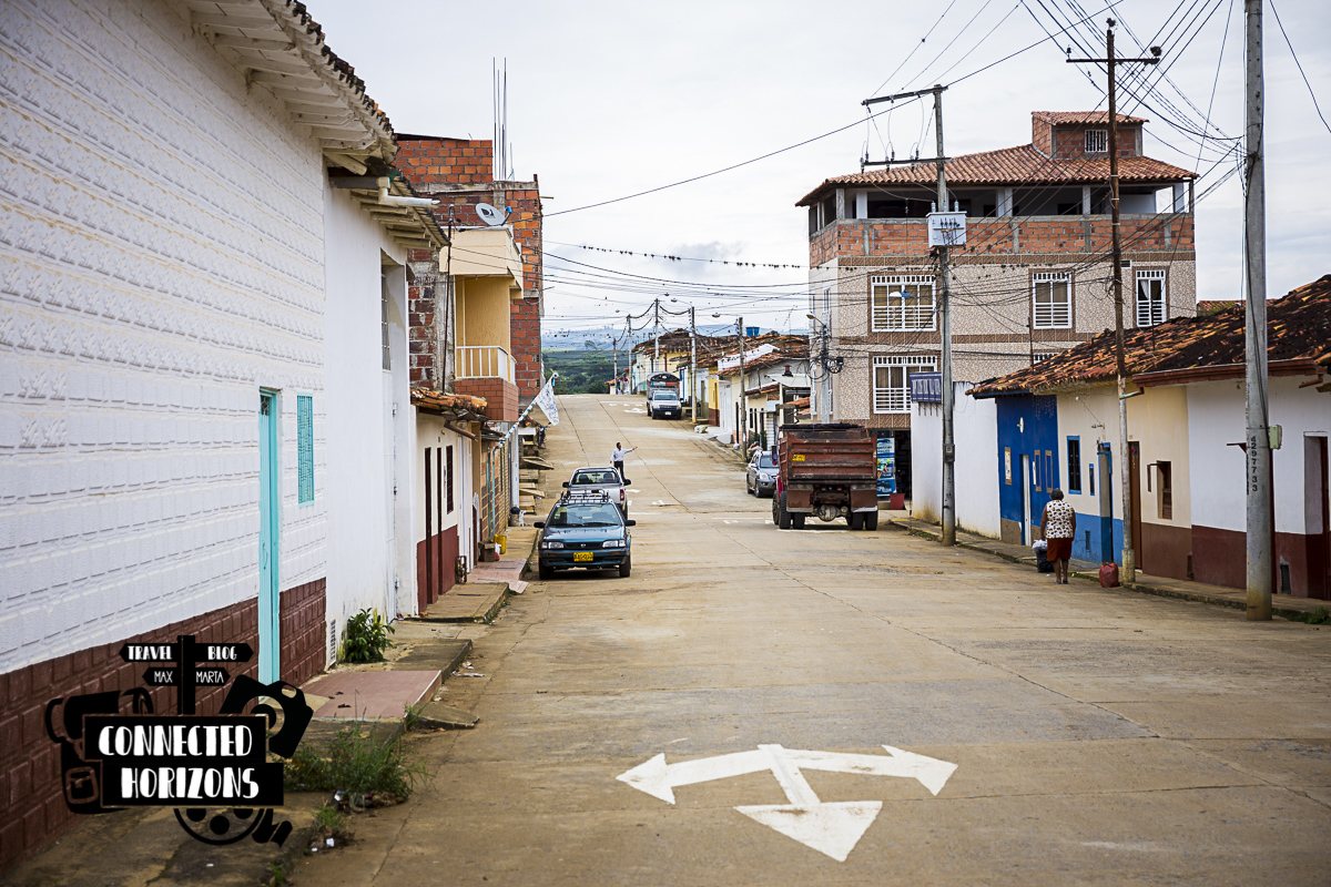
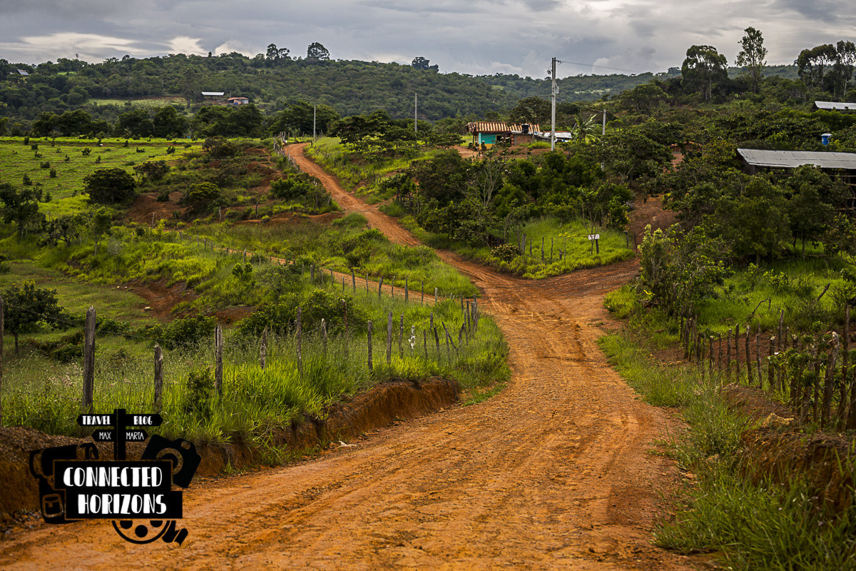
To say the truth, what we call a path is not really a path or trail but more like a wide countryside dirt road that connects the small communities scattered around with the “big” town.
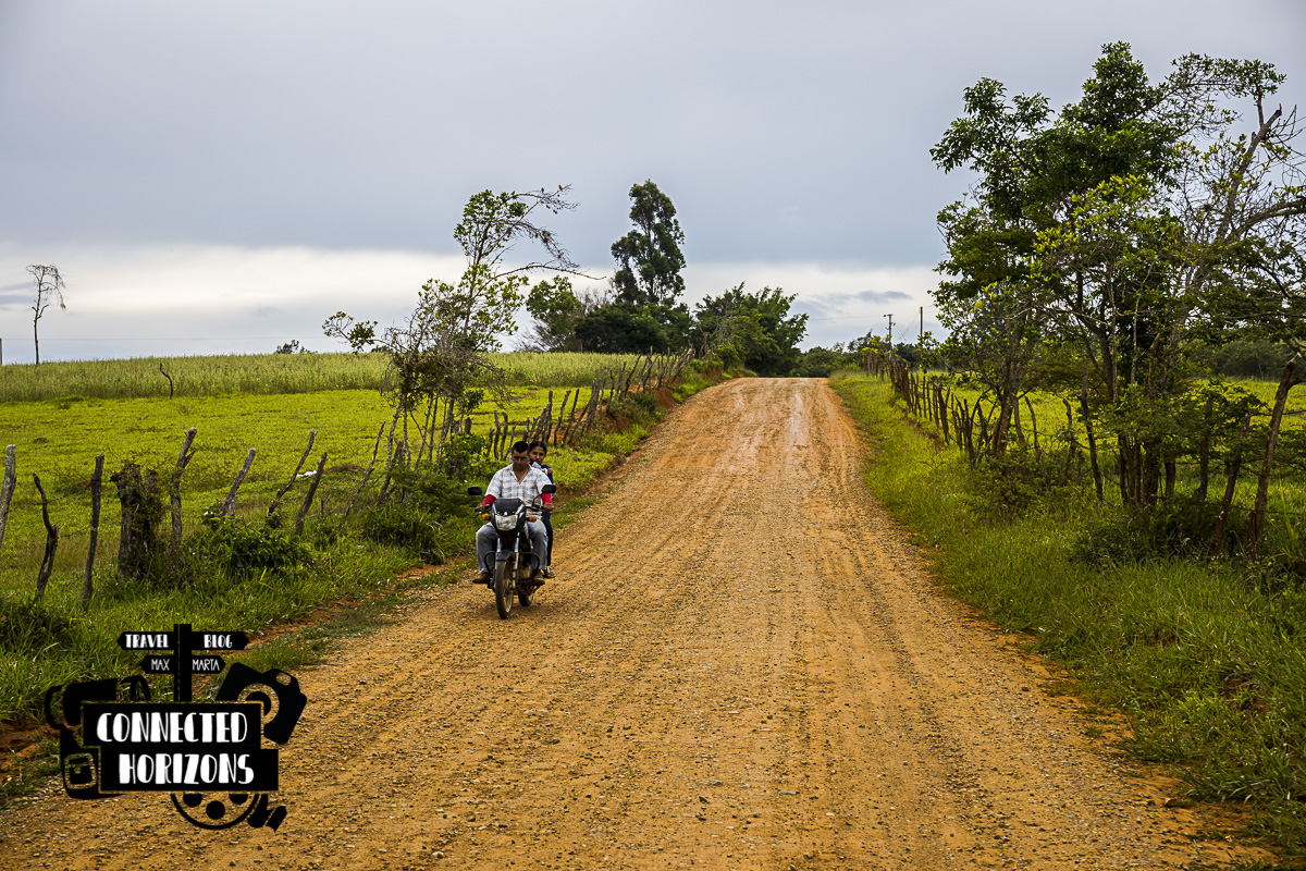
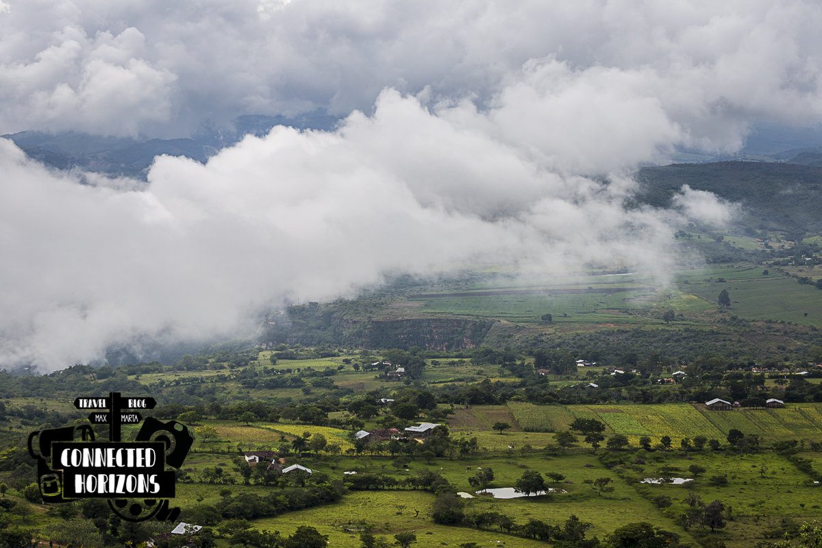
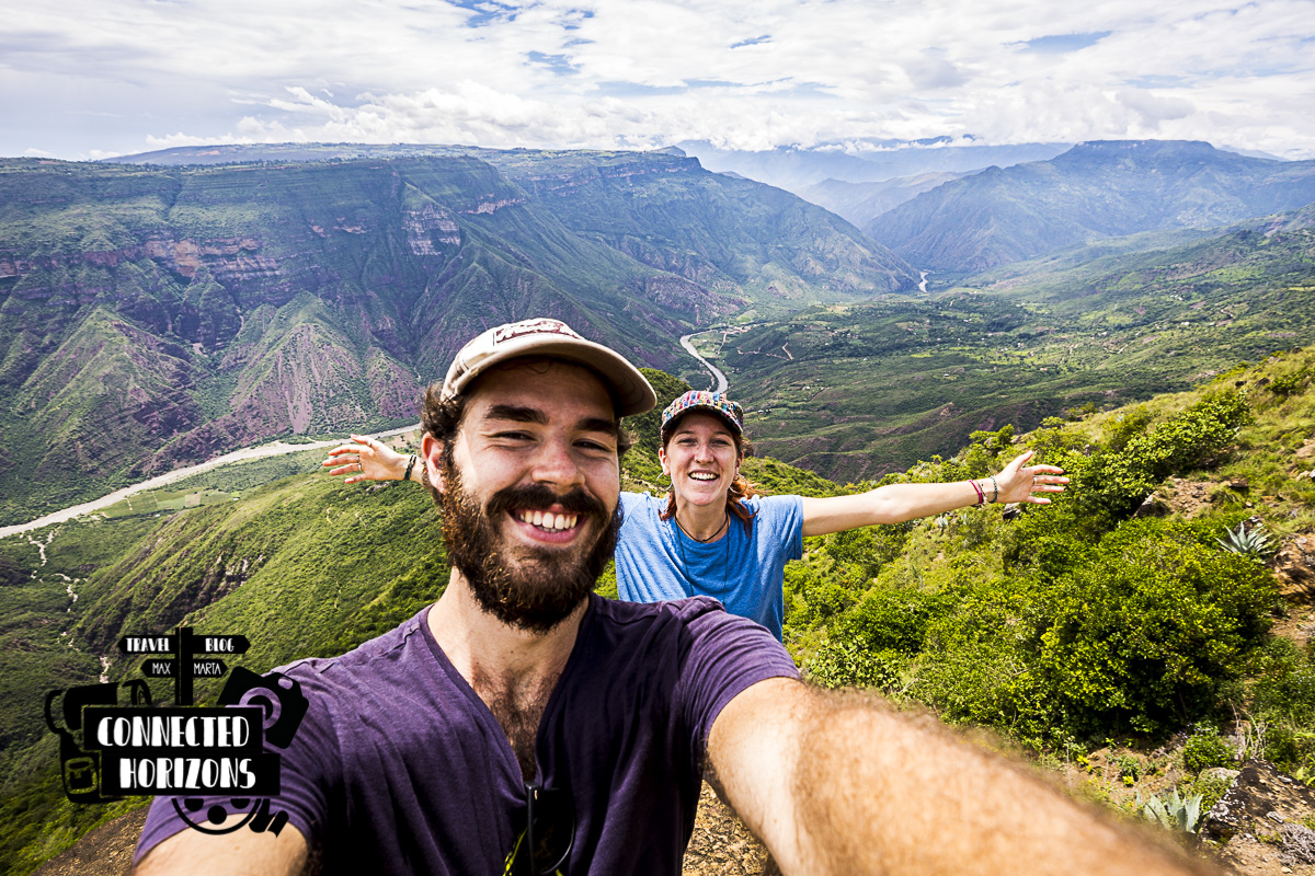
After an hour and a half of easy walking in the middle of farmlands, we reach the top of a tall hill from which we can get the first hints of the beautiful Canyon. Clouds are still covering part of it but hopefully the midday warmth will change the cards later!
 See the left bit of the canyon?
From here starts our descent down to the edge of the Canyon in search of the so much awaited Mirador. We head down a windy road, pass a junction with another main road, keep following and take a right down a path with a sign “Jordan” on it. Again here, the path is pretty smooth all the way, definitely nothing like expected! It is after 45min that we eventually reach the Mirador!
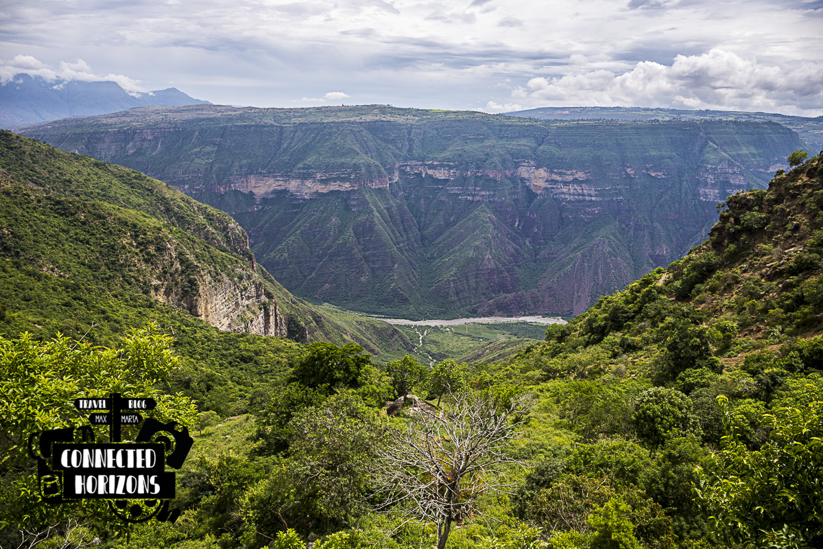 View from the free mirador
The views here are simply gorgeous! Clouds are gone and from the river down in the valley to the top of the Canyon you get to see it all: natural beauty at its best! The thing that most people don’t say here is that there are two Miradors, one free and the other paid because its on private property. Pretty much everybody will see the free one by simply following the path to Jordan but not many will opt to pay the 2000COP (less than a dollar each) to access the paid one found inside Rancho Alegre.
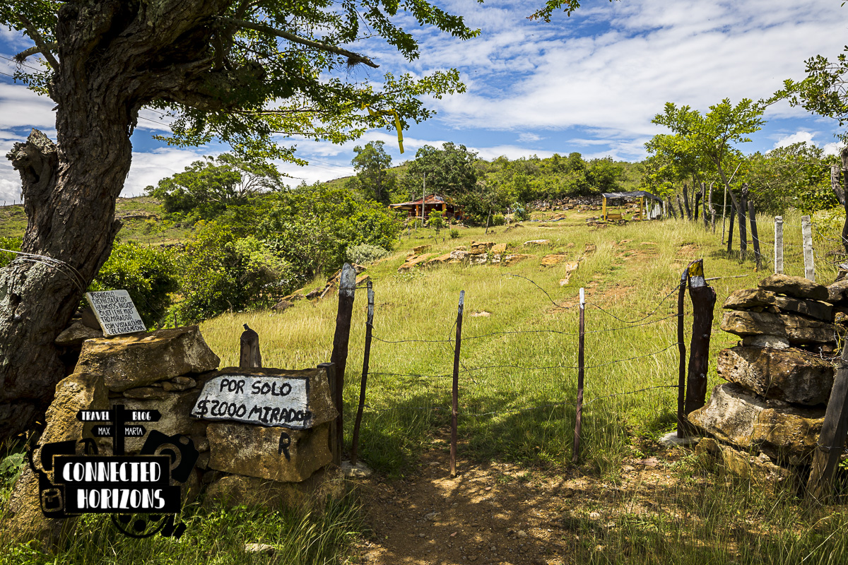 Entrance to paid Mirador
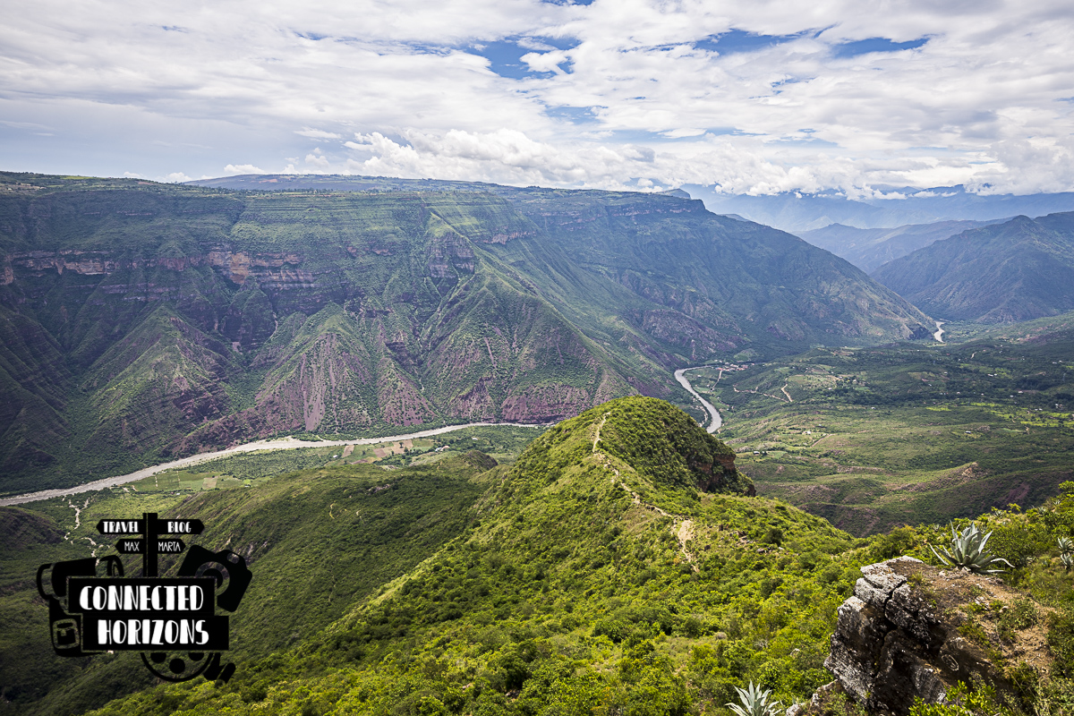
Usually, we would have thought twice before paying to see a different perspective of the Canyon but that rock there in the distance of the private property did look like the perfect spot. Well, well, well. If you think the views at the free mirador are gorgeous than you haven’t seen anything cause the views from the paid one are… SIMPLY BREATHTAKING! The best way to described those views is with the following image…
One hour, two hours and time flies by! Without realizing, it’s already midday and time for us to make a decision: down the Canyon or back to Villanueva? In a matter of seconds, the heat pretty much show us the right way to go and that’s back to Villanueva. Not a chance we’re going to walk down & up a Canyon with this boiling warmth!
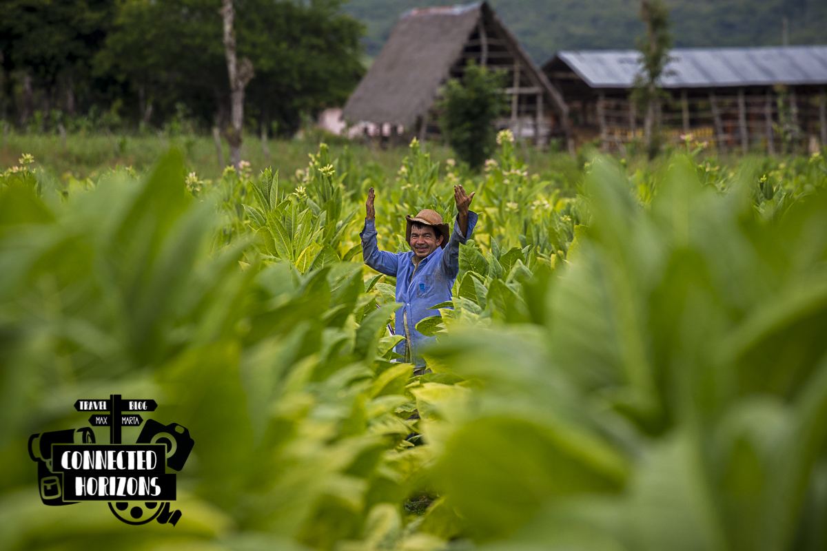
On the way back, instead of walking the same trail, we find out that there’s another path heading back to Villanueva which is longer but flatter. Here the farmers we meet on the roadside working in their mostly-tobacco plantations are super friendly, always smiling and even offer us a ride back into town when rain shows up. Could you wish for better?
Once back in town, the farmer is so nice to drop us right in front of the park where the small bus heading back to San Gil is about to leave in 5min! What a luck! A beautiful ending for a beautiful day: Jackpot!
PLANNING A TRIP TO COLOMBIA? CHECK MORE GUIDES BELOW!
[pt_view id=”1a654f191z”]
Hi,
Thank you for the great post. Do you happen to have, or know of, the GPX of the route, or any part of it? I am thinking about running this wonderful path, and a GPS watch would help a lot. Also, if you have any words of caution on safety of this route, wouldn’t mind hearing it. I take risks but I like to know them in advance. As a reference, I travel on my own to various countries where I do not speak the language, but I do speak Spanish fairly well.
Thanks,
Zé
Hi there Ze! Glad you liked the post 🙂 unfortunately I do not have the exact GPS coordinates but if you happen to use Maps.me app, that should do the trick like it did for me. On there you can clearly see the roads/paths/trails that will lead you to the canyon. Also, if you speak spanish you shouldn’t have any issues finding the trail by asking locals!
Do you remember how long the hike took you from Villanueva, out to the miradores, and back? Any guess on distance or elevation change? I want to see Chicamocha and am an avid hiker, but have some knee issues so I don’t think hiking in the actual canyon is the right decision for myself.
Hey Matt! Thanks for stopping by! The hike from Villanueva to the miradores is around 2hrs, maximum 2h30min, at a pretty relaxed pace. In terms of distance, it shouldnt be more than 6-7km each leg and the elevation change depends on which path you take, You can either take a more up & down path with better views or the flat dirt road that leads you straight to the miradores. If you have knee issues we’d suggest the latter! Nonetheless, be aware that in the last bit there a consistent slope down to the miradores, nothing hard but can be challenging for your knees. The canyon is absolutely breathtaking and hiking in it is amazing but its very hard! I think you’re making the best decision!