Once in Arequipa we only had own thing on our minds: trekking the Colca Canyon. Lots of people we met on the way sometimes didn’t even mentioned the city but the canyon right away. Surely something you can’t miss if you’re around!
On a relaxed sunny afternoon, after doing our deal of research online, we head over to the info point in Plaza de Armas to get updated information about anything from accommodation to trail status for hiking the canyon. Not long after, we leave the office we two things in mind: (1) a guide is completely not necessary and (2) it’s going to be challenging.
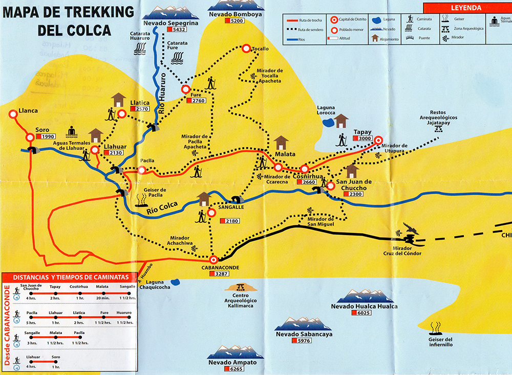
Initially, we were a bit overwhelmed about the several options in terms of trails but eventually opted for the 2 days/ 1 night plan on what’s known as the Classic “Short” Route. This involved hiking from Mirador San Miguel (Cabanaconde) to Sangalle on the first day and the getting back to Cabanaconde (and Arequipa) on the second day.
Make sure to check out our Ultimate Guide of the Colca Canyon for info about routes, accomodation, transport and other tips but also the article about Costs of Hiking the Colca Canyon.
First Day
Time: 6-7h | Difficulty: Medium-Hard
MIRADOR SAN MIGUEL TO SAN JUAN DE CHUCCHO
Time: 2h45min | Difficulty: Hard
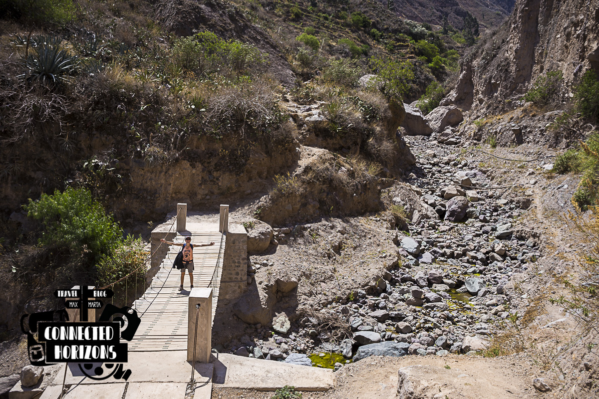
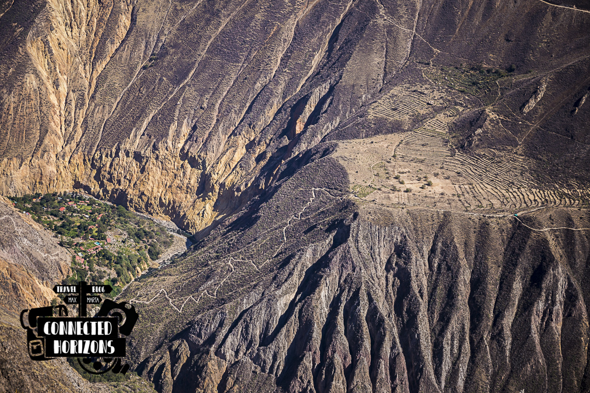
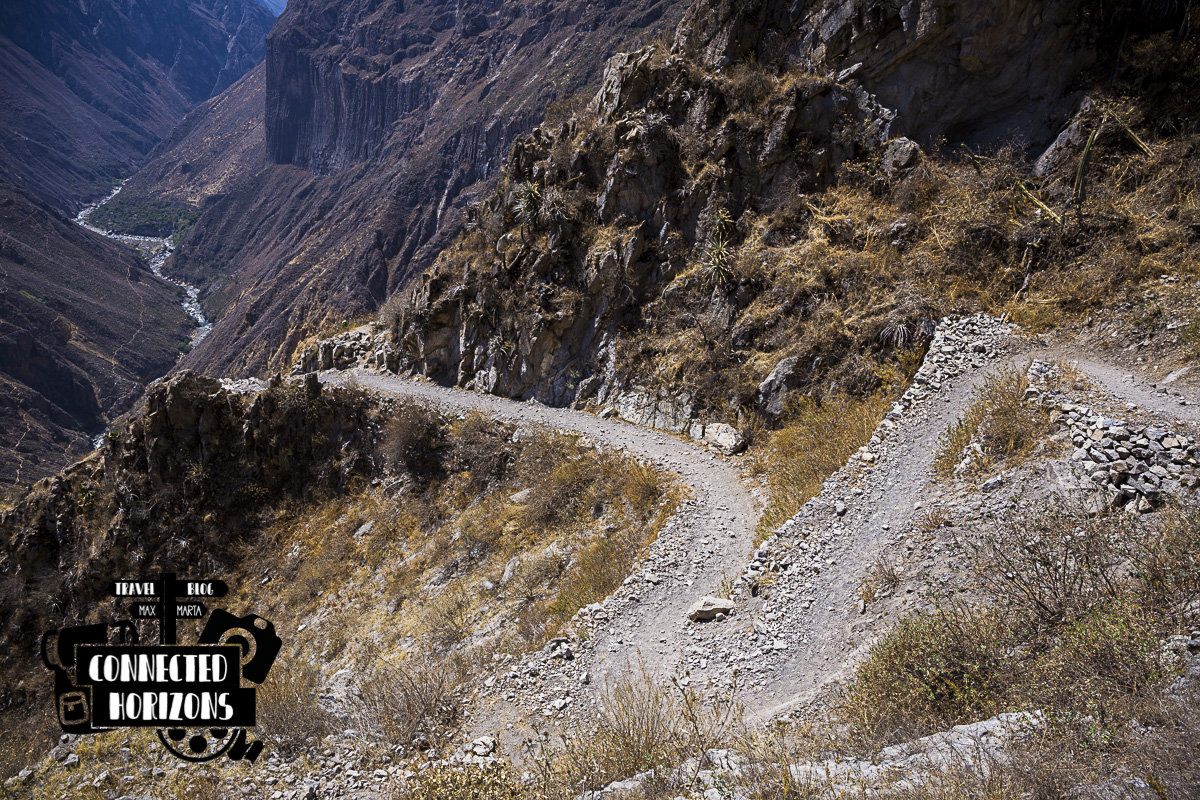
After having the chance to see vultures flying around by the canyon walls at the Cruz del Condor, we only have a 10min ride left for the start of the trail. Once at the Mirador San Miguel, is pretty easy to figure out which is the way down (only one path) and by 9am we officially start the hike. This section is pretty much a constant steep descent until the bottom of the canyon where we take a break at the wooden bridge crossing over the river Colca. Here’s also where they check our Tourist Ticket for the first time.
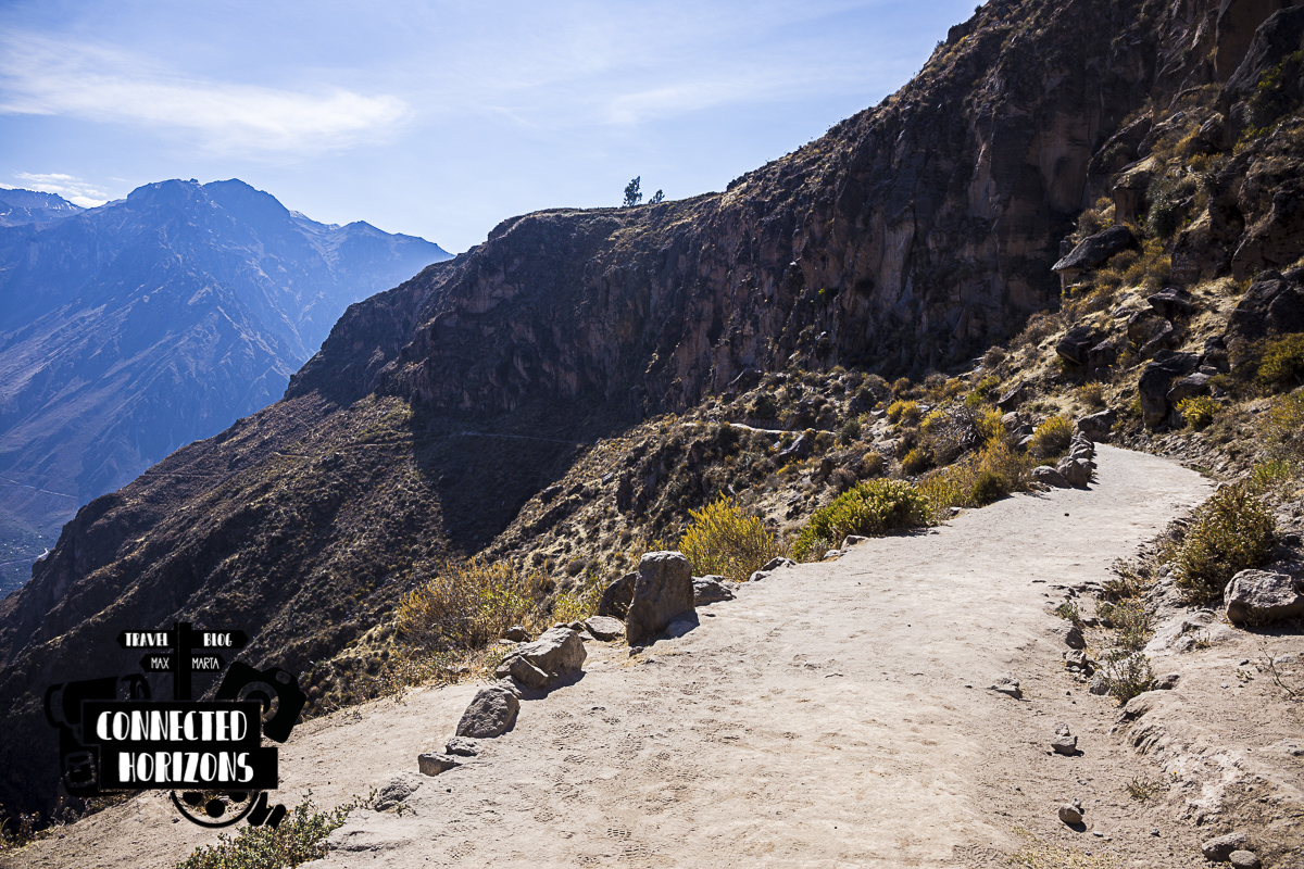 Start of the trail at Mirador San Miguel
At this point, there are two routes to get to the village of San Juan de Chuccho; a long one (≈45min) which is the main path or a short one (≈25min) which is a lovely riverside into-the-woods path. Just after the bridge, the steep path on the left will lead you to the short route and the more gradual path on the right is the long route.
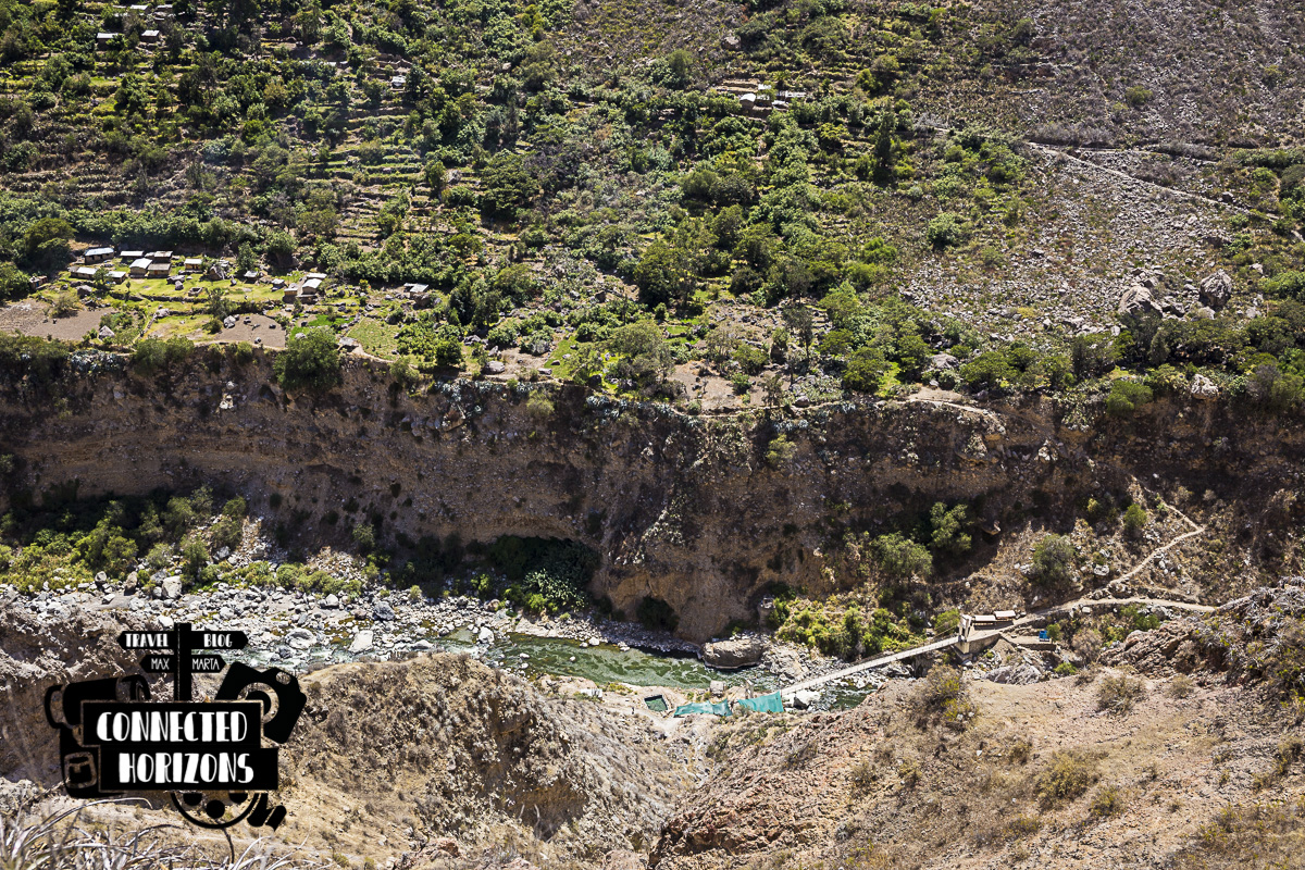 Wooden bridge to San Juan
Be aware that on the short route you’ll see a woman selling fruit at a small stand and if you refuse buying something she will insist that you cannot keep walking unless you pay a fee because its “private property”. This is a big lie/scam, in fact the path is public & free so just keep walking and don’t let her persuade you in any way.
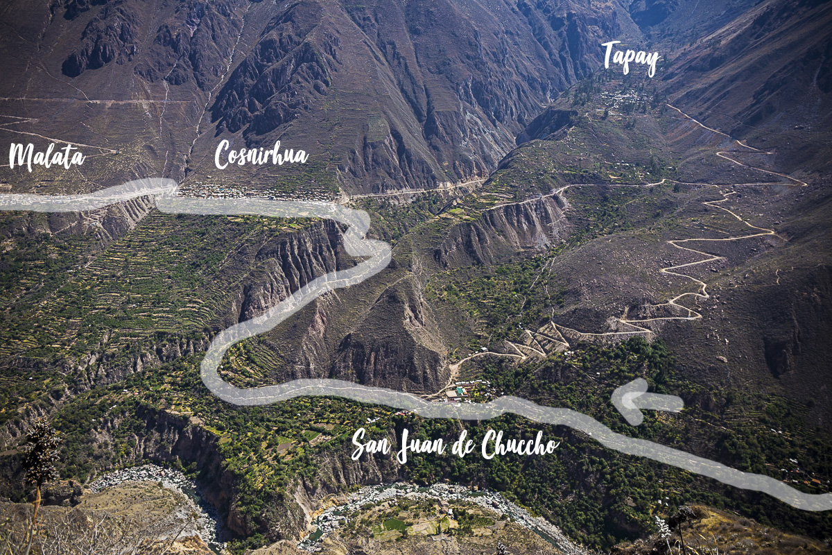 The path we took through San Juan, Cosñirhua and Malata
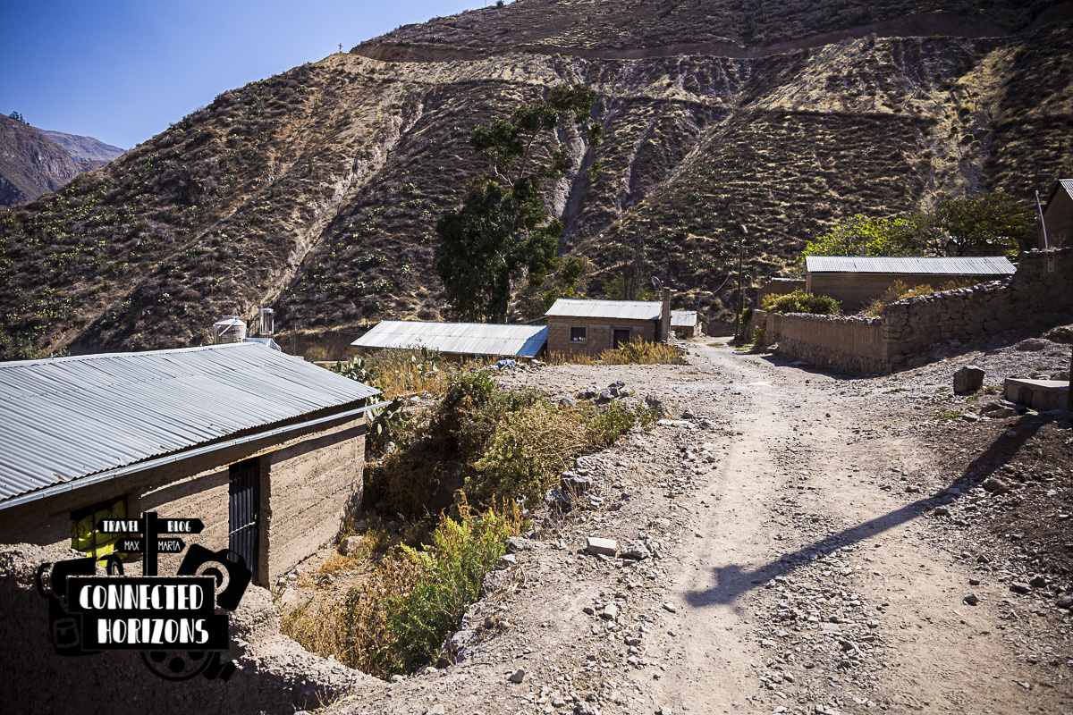
SAN JUAN DE CHUCCHO TO COSÑIRHUA
Time: 1h15min | Difficulty: Hard
Just after the trail becomes one of the village alleys, we end up in the garden of the only shop/restaurant/homestay open at the moment: Posada Gloria. The place can be a good place for lunch break (15 soles the menu) but other than that we don’t really see any charm. Contrairly to the small villages on the Quilotoa Loop that offered some gorgeous views, here is just a village at the bottom of a canyon with nothing really standing out. Obviously, opinion can differ but we wouldn’t spend the night here!
 Another small bridge before Cosñirhua
A quick 15min food break at the village and we’re back on the road to Cosñirhua. This section of the trail is very steep and for little more than an hour is a constant ascent under the sun until you reach a small stand at the doorstep of the Cosñirhua. Definitely harder than expected.
 Cosñirhua village in the distance
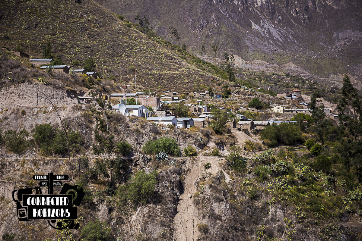
COSÑIRHUA TO MALATA
Time: 15min | Difficulty: Easy
In Cosñirhua there’s literally the bare minimum in terms of accomodation (just one homestay which was closed at the time) but at least there are a couple of shops to get some fresh drinks. On the walk, this was the only village where we didn’t see/hear anybody as we passed through and kinda felt abandoned.
 Village of Malata
From here getting to the neighbouring village of Malata is a relaxing flat walk on a dirt road which, we later got to know, is also connected by bus from Cabanaconde. Similarly to Cosñirhua, also Malata has a kind of desolated atmosphere but interestingly enough here there’s a nice central plaza with a church, more accommodation options including a hostel, restaurants and more shops. You can clearly tell that this is the more touristy of the two!
 Arriving at the Oasis
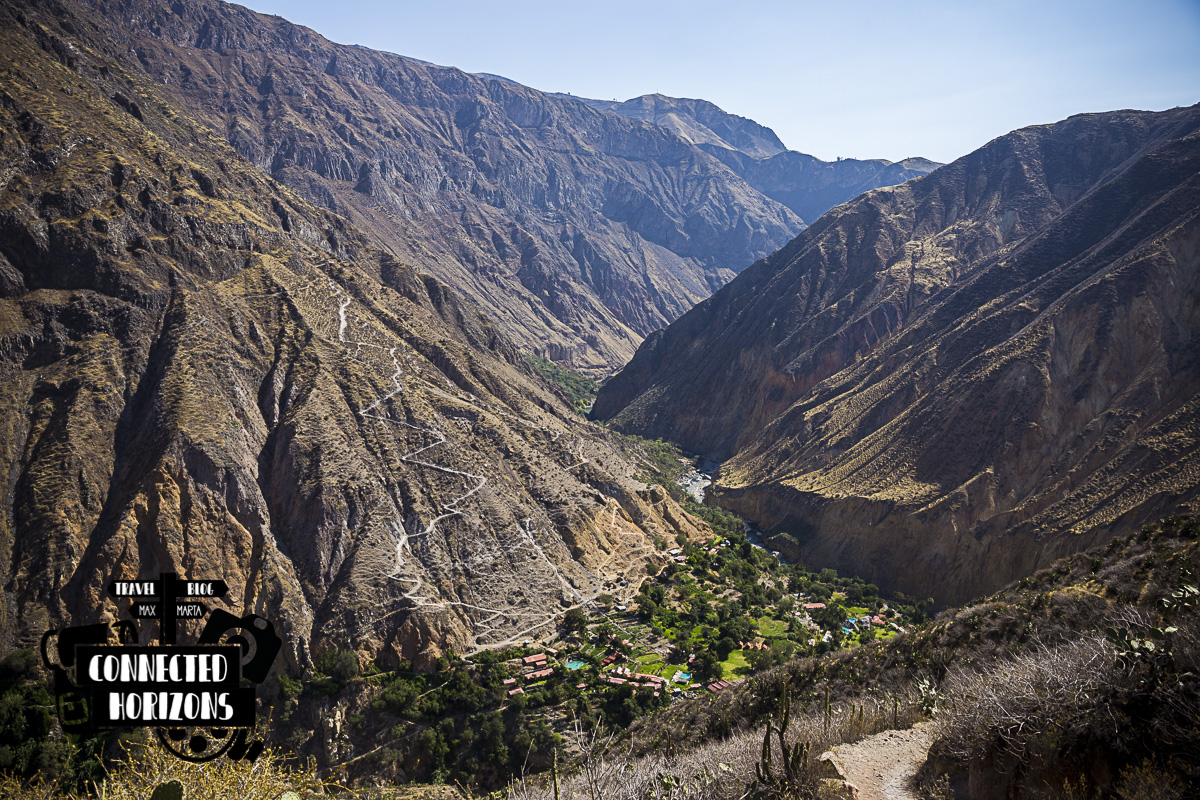
MALATA TO SANGALLE (THE OASIS)
Time: 1h30min | Difficulty: Medium
After walking to the end of the village we keep following the signs and start our descent for our final destination: Sangalle (Oasis). This last section of the trail is very similar to the descent we did to get down to San Juan de Chuccho but even though is kinda of easier, after trekking for more than 4 hours we started feeling the weight of the backpacks. In the last part of the descent, at a mirador there’s small stand in the shade selling drinks and snacks; we suggest you to stock up here cause its consistently cheaper than buying anything in Sangalle.
After the descent, we arrive at a bridge which is also the beginning of the Oasis. Once there, we only need to climb up a couple more curves to get to the actual heart of the town where all the hotel/hostels are. TIP: In Sangalle there are 5 accommodations options all with swimming pools, there are no shops or restaurants so be 100% sure in which one you decide to spend the night.
 The oasis in all its beauty
Second Day
Time: 3-4h | Difficulty: Hard
Sangalle to Cabanaconde
Yesterday, we arrived in Sangalle we more than enough time to enjoy the swimming pool, have a drink and relax our muscles before the last hard part of the trek. In fact, all this time we’ve been mostly going down from the top of the Canyon at 3200m to the bottom at 2100m but today we have to cover all this altitude difference all in one go. At 7.30am with the sun starting to poke out from behind the horizon, we decide start the last part of this two-days hike.
 Short section of the path to the top
In the end, it takes us 3h15min (including many short breaks) to get back to the top of the Canyon but it is far from being an easy trek. For about the first 2.5 hours or so, the sun is still not so annoying and we can find shade at every corner but after that it feels like walking on a frying pan. Nevertheless, the breathtaking landscapes along the trail are completely worth the hellish walk up and without a doubt we would do it again. TIP: Don’t leave later than 7.30am from Sangalle and make sure to bring plenty of water along cause you won’t find any shops along the way!
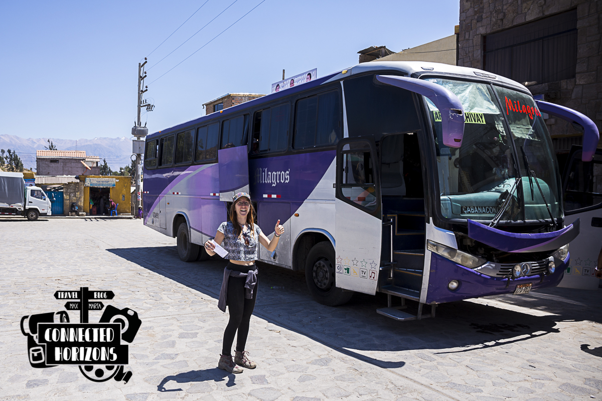 A very happy Marta waiting for the bus to leave
At 11am, after a short 15min easy walk into town, we’re sitting in front of Cabanaconde’s church eating an avocado sandwich while waiting for the bus to Arequipa (17 soles) leaving a 11.30am.
Well done team: 2 days, 1100m of altitude difference, several kilometres and many hours later. We did it, we trekked the Colca Canyon!
PLANNING A TRIP TO PERU? CHECK MORE POSTS BELOW!
[pt_view id=”8828c57k10″]
Wow! What a beautiful hike! I love posts like these that lay out all the details – like length and difficulty. I love hiking and Peru looks absolutely stunning. Hoping to make it there in the next couple years!
It was indeed a beautiful hike! Just a little exhausting on the way back! And if you like hiking you should definitely head over to Peru, here there are plenty of beautiful hikes in the mountains, canyons and even in the desert!!!!