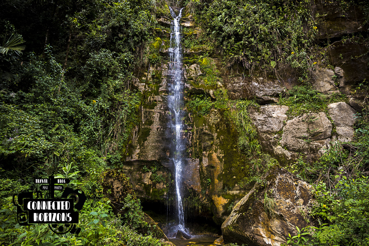
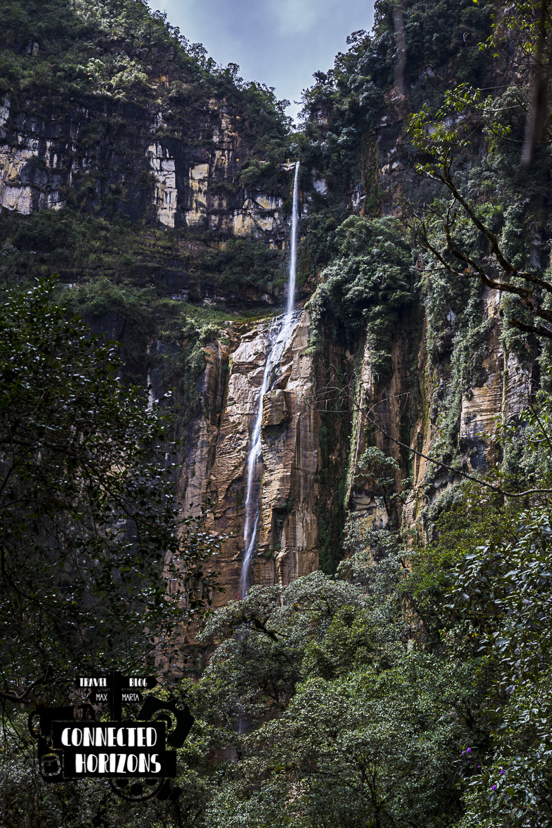
It’s not everyday that you get to see one of the waterfalls listed among the tallest top ten waterfalls in the world. The Yumbilla waterfall is located at a short hike from the Cuispes, a small village just next to the town of Pedro Ruiz Gallo, a very known stop before reaching the touristy Chachapoyas. After the long journey to cross into Peru from Ecuador, on our second day in the country we decide to take on this hike. Here’s a little guide to help you plan it!
Getting there
First of all, you need to get to Pedro Ruiz Gallo, either by taking a combi or auto from Bagua Grande (5 or 10 soles), doing the same from Chachapoyas (5 or 8 soles) or simply by staying the night at one of the hostels in town (like we did).
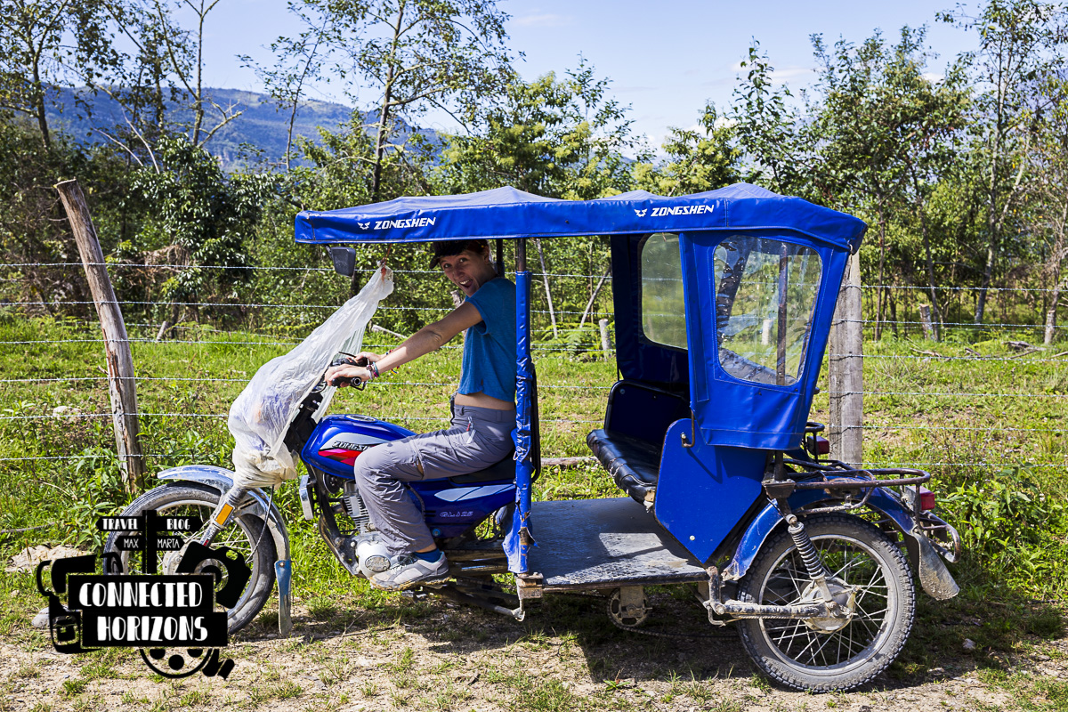 Tuk-yuks or mototaxis
The next step is to get to Cuispes. This small village lies up in the hills next to Pedro Ruiz at just 30-min ride by tuk-tuk (15 soles) or 20-min ride by taxi 25 soles). On the way back, both tuk-tuks and taxis are 5 soles less expensive (10 and 20 soles respectively) cause the road is all downhill and they barely have to use the engine!
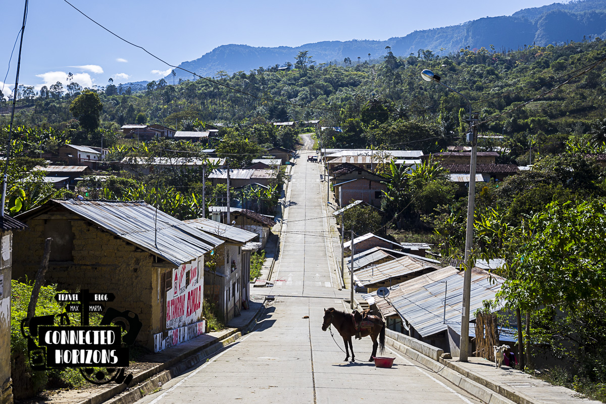 Town of Cuispes
Hiking paths
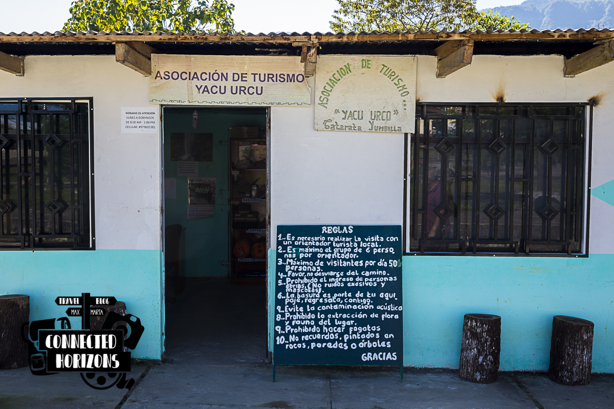
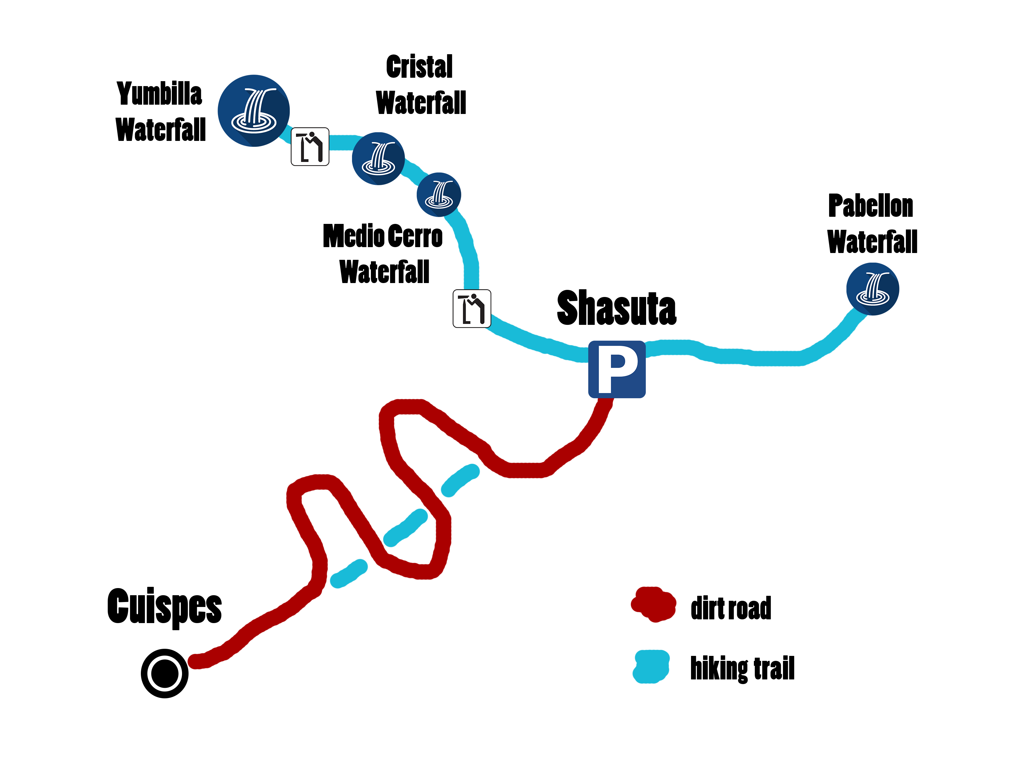
Currently, the hiking path is divided into two parts: getting to Shasuta and getting to the waterfall. Before hiking remember to register at the Tourist Office Yacu Urcu in town and pay your entrance fee (10 soles/pp) for the waterfall.
 You can also rent boots, tents or walking poles here
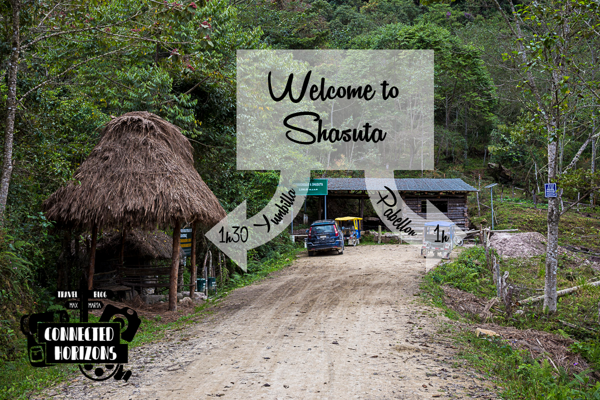
TO SHASUTA
The official entrance for the waterfall path, also known by everybody as Shasuta is located just outside the town of Cuispes. In order to get there, you have two options.
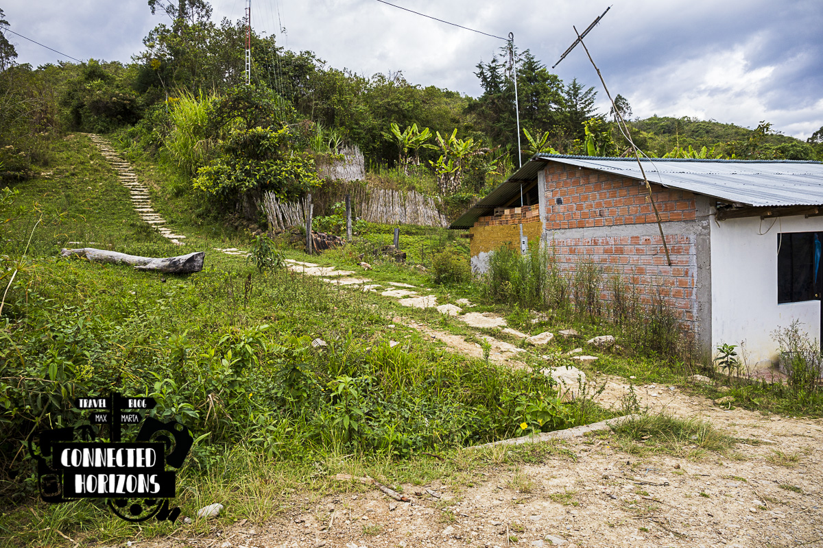 Start of the trail which late joins the dirt road again
Either hike up a trail that starts just off town (slightly muddy) until you reach a dirt road and follow that up until the entrance. This takes about 1h walking at a normal pace (and 45min back), path difficulty is easy.
TIP: This path intersect the dirt road three times but if you wanna avoid most of the mud make sure to leave the trail and follow the road at the first intersection. Check map below.
Or take a tuk-tuk (10 soles) or taxi (20 soles) for a quick 10-15min ride on the same dirt road.
 “Homemade” Trail map for Yumbilla
TO YUMBILLA
In Shasuta you can find two trails: right heading to Cascada Pabellon (most people go here to do rock-climbing and rappelling) and left to Cascada Yumbilla.
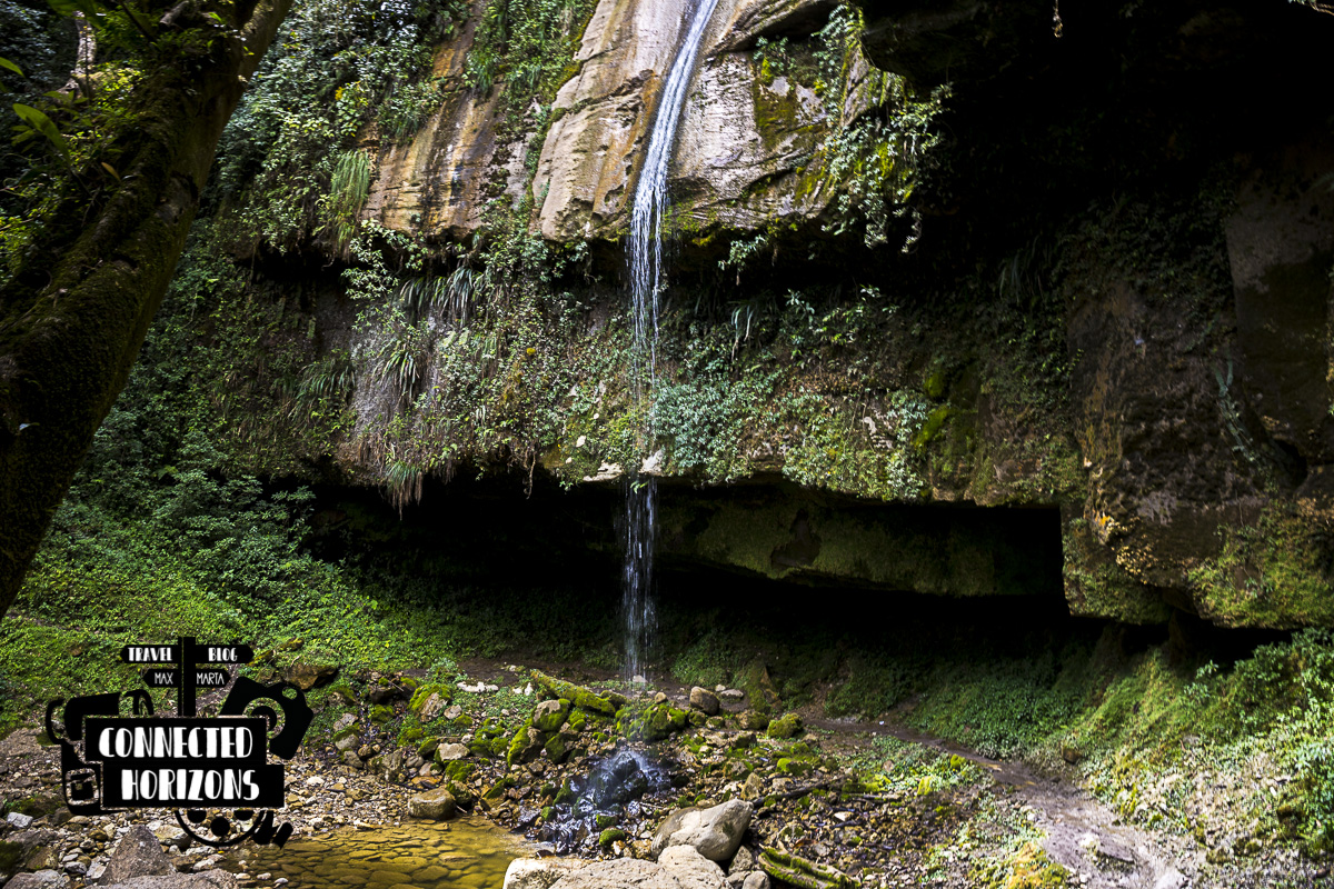
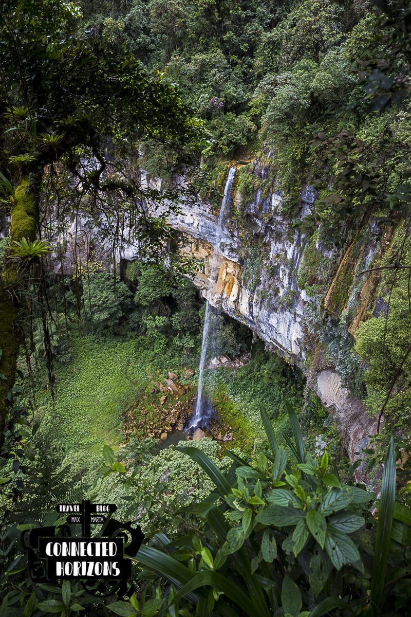
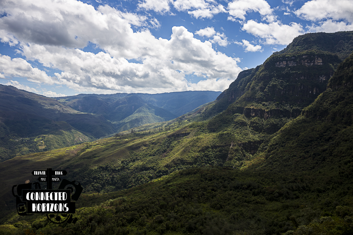
The path to the Cascada Yumbilla is pretty up-and-down and doesn’t only feature the main sight but also some others nice waterfalls and even a couple of lookout points. In this order, by walking down the path you gonna meet the first most-amazing mirador (15min walk), Cascada Medio Cerro (30min walk), Cascada Cristal (40min walk), another Mirador (1h walk) and finally the Yumbilla waterfall (1h20min walk).
In total the hike takes between 1h15min to 2h, depending on your pace, stops and level of fitness. On the way back, if you’re not planning on stop to the mirador and take less breaks it should take you less than 1h.
 View from the first mirador
All in all, even though the waterfall was not as impressive as we thought it would (possibly because it wasn’t rainy season), the hike was a very nice half-day spent wandering in the nature and seeing, how could we not repeat this enough times, the 5th tallest waterfall in the world!
PLANNING A TRIP TO PERU? CHECK MORE GUIDES BELOW!
[pt_view id=”c969b5d80o”]